Geography: Exploring the Landscapes of the World and Their Meanings
Geography is much more than simply describing places on a map. It is a discipline that encompasses the exploration and understanding of the landscapes of the world as a whole, from the vast expanses of the oceans to the intricate networks of cities and human communities. Through observation, analysis, and interpretation, Geography offers us a window into the diversity and complexity of the Earth's surface and the interactions taking place on it.
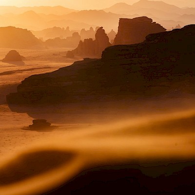
At its core, Geography focuses on the study of the Earth and everything that inhabits it. It examines the physical characteristics of the planet, such as topography, climate, vegetation, and hydrography, as well as the natural processes that shape these elements. From the snowy peaks of mountains to the fertile plains of agricultural regions, Geography helps us understand how nature shapes our environment and how we, as humans, interact with it.
Geography Goes Beyond the Physical
This discipline also delves into the study of human societies and their cultural landscapes. It examines how people organize space, build cities, manage resources, and establish relationships with the natural environment. From bustling metropolises to traditional rural communities, Geography offers us a unique perspective on cultural diversity and the complexities of human life in different parts of the world.
Integrative Approach
One of the strengths of Geography is its integrative approach. By combining the study of the physical and the human, Geography allows us to understand the complex interactions between the environment and society. It helps us analyze global issues such as climate change, uncontrolled urbanization, loss of biodiversity, and socioeconomic inequality from a holistic perspective.
A Dynamic Discipline
Furthermore, Geography is a dynamic and ever-evolving discipline. With the advancement of technology, geographers use tools such as geographic information systems (GIS), remote sensing, and digital cartography to collect data, analyze patterns, and model processes on scales that were previously unimaginable. These new tools allow us to address global issues with greater precision and anticipate the challenges of the future.
Geography is an exciting science that invites us to explore and understand the landscapes of the world in all their diversity and complexity. Whether we are studying the formation of mountains, the distribution of the world's population, or the effects of climate change, Geography provides us with the tools and knowledge to understand our planet and forge a sustainable future for future generations.
Frequently Asked Questions
Sure, here are some answers to those questions:
What is Geography and why is it important?
Geography is the science that studies the Earth's surface, its forms, physical characteristics, climate, population, political divisions, and other phenomena. Its importance lies in understanding how humans interact with the environment and how these factors affect life on Earth.
What are the main branches of Geography?
The main branches of Geography are Physical Geography and Human Geography. The former focuses on the study of physical aspects such as relief, climate, hydrography, among others, while the latter focuses on the relationship between human societies and their environment.
How does Physical Geography relate to Human Geography?
Physical Geography and Human Geography are closely related, as the natural processes studied in Physical Geography, such as mountain formation or erosion, influence the distribution of population, economy, and culture, aspects studied in Human Geography.
What physical aspects does Geography study?
Physical Geography studies aspects such as relief, climate, vegetation, hydrography, soil, and biogeography.
What are the main elements of the physical landscape?
The main elements of the physical landscape are relief, climate, vegetation, bodies of water, and soil.
How do natural processes influence landscape formation?
Natural processes such as erosion, sedimentation, plate tectonics, and climate influence landscape formation by modifying the Earth's surface and shaping its appearance.
What is Human Geography and what aspects does it cover?
Human Geography is the branch of Geography that studies the relationship between human societies and their physical environment, as well as population patterns, economy, culture, politics, and other related aspects.
How do human societies organize themselves in space?
Human societies organize themselves in space by creating cities, infrastructures, transportation and communication systems, as well as distributing the population in urban and rural areas.
What role do cities play in the study of Human Geography?
Cities are centers of economic, political, and cultural activity that play an important role in the study of Human Geography, as they concentrate population, resources, and social activities.
What is the importance of the interaction between society and the environment in Geography?
The interaction between society and the environment is crucial in Geography, as it determines how human activities affect and are affected by the physical environment, which has implications for sustainability and quality of life.
What tools and technologies does Geography use in its research?
Geography uses tools such as Geographic Information Systems (GIS), remote sensing, Global Positioning Systems (GPS), and digital cartography to collect, analyze, and represent geographical data.
How does Geography contribute to the study of global issues such as climate change and urbanization?
Geography contributes to the study of global issues by providing spatial analysis, modeling of phenomena, and impact assessment, allowing for a better understanding of the causes and consequences of these problems and the development of mitigation and adaptation strategies.
What are the future challenges facing Geography as a scientific discipline?
Some future challenges for Geography include integrating large-scale spatial data, developing more accurate predictive models, and applying interdisciplinary approaches to address complex problems.
What kind of data is used in Geography and how is it analyzed?
Geography uses geospatial data, such as cartographic information, satellite images, climate data, and socioeconomic statistics, which are analyzed using statistical techniques, spatial modeling, and geospatial analysis.
How has Geography evolved with the advancement of technology?
Geography has evolved with the advancement of technology by adopting digital tools and more sophisticated spatial analysis techniques, which have expanded the capabilities of data collection, processing, and visualization of geographical data.